|
|
|
Welcome To The Mountain Meadows Homepage
A b i r d ' s e y e t o u r.
Aerial images photographed over the Mountain Meadows Reservoir area since April 1, 2000.
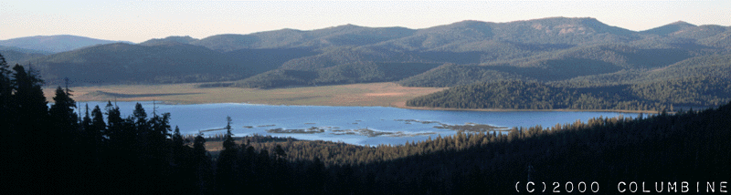
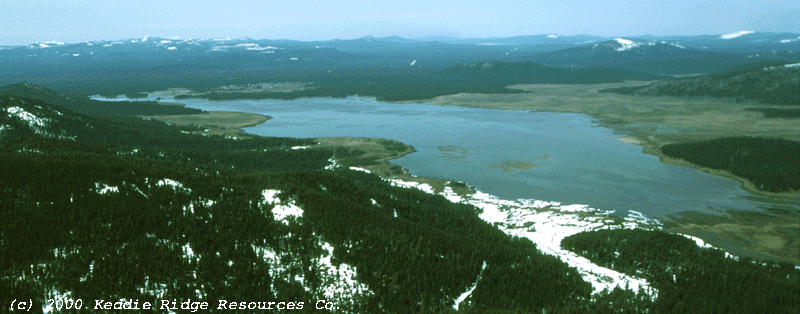
Mountain Meadows Reservoir is the uppermost hydroelectric facility on PG&E’s North Fork Feather operations. It is located just south and east of Westwood, California, and lies upon lavaflows from the Modoc Plateau. This geology creates meadows and marshland habitats which are more extensive than any of the other areas being considered for auction in the divestiture of PG&E's California hydroelectric facilities. The Mountain Meadows Reservoir area may have some of the highest waterfowl habitat value for PG&E lands in Northern California.
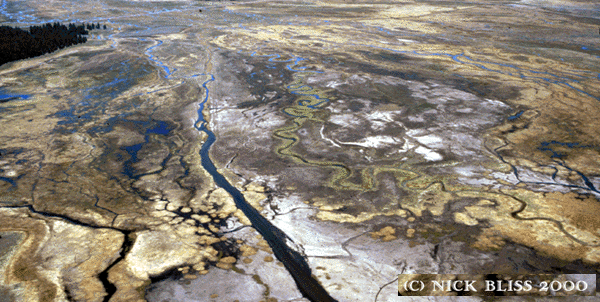
Mountain Meadows Reservoir is shallow and creates over five thousand (5,000) acres of wetland marsh. PG&E’s ownership includes the reservoir and lands 200 horizontal feet beyond shoreline at maximum spillway elevation, they also own several meadow areas contiguous to the lake (see map). The lake/marsh areas provide habitat for migratory waterfowl, and the meadows provide habitat for sensitive or threatened species including the Greater Sandhill Crane, Swainson Hawk, and Willow Flycatcher. A "Conceptual Area Acquisition Plan" prepared in 1991 by the California Department of Fish and Game(CDFG) documented 8 threatened or endangered species and 21 species of special concern within the Mountain Meadows area, and gave the area its highest possible rating for acquisition by the Wildlife Conservation Board.
"The diversity of habitats and assemblage of species present (in the Mountain Meadows area) are significant at the statewide level. This complex is not currently under Significant natural Area designation but clearly qualifies" (excerpted from the 1991 CDF&G report).
PG&E access currently allows the public to use the area for duck hunting, bird watching, fishing, ice-skating, and relaxation. Proponents of a resort development project have an option to buy over 4,000 acres of Roseburg Resources land (see map) adjacent to the reservoir, and have expressed interest in acquiring the lake and meadow areas at auction. While potential wildlife impacts from residential and resort development adjacent to the lake are unclear, opportunities for habitat improvement and stream/meadow restoration abound. Livestock grazing has contributed to the degradation of many of the Willow channel and meadow areas (CDF&G 1991), especially in the shallow marsh areas along the Reservoir, where fluctuating lake levels often create a seasonal marshy cowbog.
Many of Westwood's residents have grown up hunting and fishing in the area, and while there is local interest in seeing the Reservoir and adjacent meadow areas managed for wildlife habitat, preservation of local hunting access is a very important issue for many.
For more information on the Mountain Meadows Area - visit the Mountain Meadows Conservancy webpage.
To view more aerial photographs of the Mountain Meadows Area - visit the Mountain Meadows Mead's Conservation Pages.
Photography and image design (C) 2004 by the Keddie Ridge Resources Co.


